


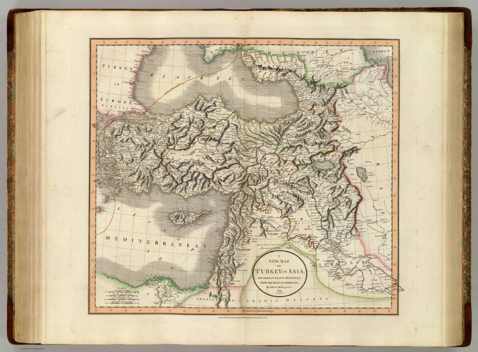
A new map of Turkey in Asia, divided into its provinces, from
the best authorities. By John Cary, engraver, 1801. London:
Published by J. Cary, Engraver & Map-seller, No. 181, Strand,
Decr. 21, 1801.
who: Cary, John, ca. 1754-1835; John Cary.
what: World Atlas; Atlas Map
when: 1801
where: Turkey; Syria; Middle East
Author: Cary, John, ca. 1754-1835
Date: 1801
Short Title: Turkey in Asia.
Publisher: London: John Cary.
Type: Atlas Map
Obj Height cm: 47
Obj Width cm: 53
Scale 1: 3,900,000
Note: Engraved map. Boundaries in outline hand col.
Relief shown pictorially. "41" pasted on verso.
Country: Turkey ; Syria
Region: Middle East
Full Title: A new map of Turkey in Asia, divided into its
provinces, from the best authorities. By John Cary, engraver,
1801. London: Published by J. Cary, Engraver & Map-seller, No.
181, Strand, Decr. 21, 1801
List No: 1657.043
Publication Author: Cary, John, ca. 1754-1835
Pub Date: 1808
Pub Title: Cary's new universal atlas, containing
distinct maps of all the principal states and kingdoms
throughout the World. From the latest and best authorities
extant. London: Printed for J. Cary, Engraver and Map-seller,
No. 181, near Norfolk Street, Strand, 1808.
Pub Reference: Phillips, 714; Fordham, J.C. John Cary, p.
77-82; The map collector, 43, p. 40-47; National Maritime
Museum. Catalog, v. 3, no. 311.
Pub Note: The 1st ed., with a list of subscribers.
Fordham lists eds. of 1808, 1811 (reissue of 1808, no maps
changes other than the 1811 date appearing on some of the maps),
1819 (one third of the maps amended), 1824 (maps unchanged from
1819 except for the date), 1828 (same as 1824, except for date
changes, with reissues in 1833, 1836 (Baskes), and 1844). This
is a fine atlas, one of the best of its period, and a source for
American mapmakers (Tanner directly copied the World and
continental maps for his New American Atlas). Fordham: (The
maps) "are finely engraved, with full details, showing
especially the water-ways and roads, and hill-shading, and are
usually coloured. The work is very clear and delicate and of a
uniform character throughout." Maps are hand painted in outline
color and bound in half leather brown boards with "Cary's Atlas.
1808" stamped in gilt on the new leather spine.
<< BACK